


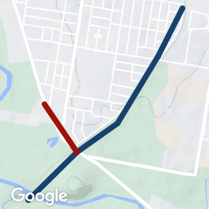
- A short but exciting trail next to the disused Dubbo to Molong railway line
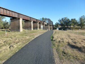
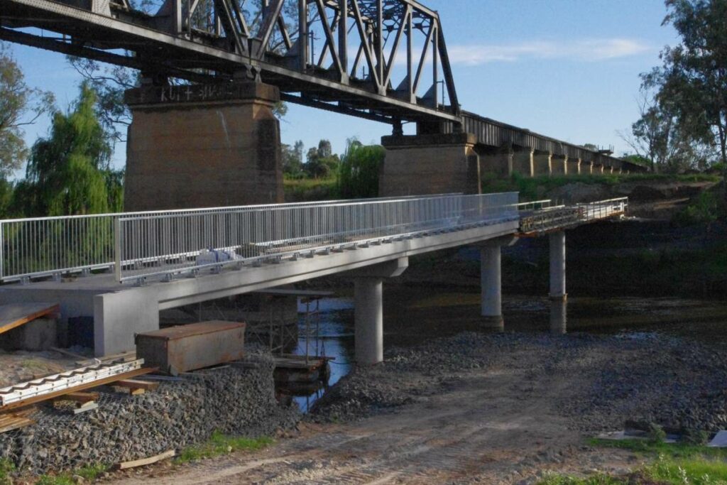
- Views of an old railway trestle viaduct and a huge concrete and steel railway bridge
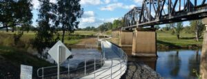
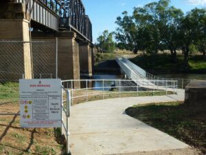
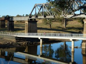
- Ride across Macquarie River, with river red gums and abundant birdlife. Close to Western Plains Zoo and historic Dundullimal Homestead
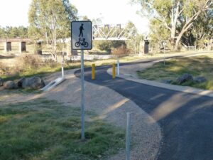
- Fully sealed and family friendly, suitable for all kinds of bicycles, scooters, mobility scooters and prams
- Interpretive signs explain the history of the rail line and the region
- Links up to the Tracker Riley Cycleway network
- Links up to the Southlakes Cycleway Network via the Hennessey Road cycleway
Nearby Attractions
Great news! This trail has now been completely sealed along the entire length
- Western Plains Zoo
- Restored Historic Dundullimal Homestead
- Ride the entire Tracker Riley Cyclepath alongside the river
- Stop at the zoo or Dundullimal for a refreshing coffee and cake
- Check out Dubbo’s other railway bridge on the north side of town as you ride beneath it
- Several vineyard cellar doors nearby
Last updated: 21 November 2022
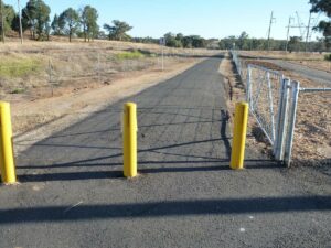
Access Points
- High St and Margaret Cres junction
- Macquarie St and Margaret Cres junction
- Dundullimal Homestead
- Turn off to Dundullimal from Obley Rd
- Western Plains Zoo
Section Guides
Western Plains Zoo to Dundullimal (3 km)
The sealed path follows the Obley Road south from the Zoo. There is a short uphill stretch after crossing a small bridge, then at Dundullimal you can go the right to Dundullimal or straight ahead to the river.
Dundullimal to Macquarie St (1.5 km)
Leaving Dundullimal, rejoin the cycle path and head northeast toward the river. Follow the path across the river and alongside the old rail line to Macquarie St.
Macquarie St to High St (2 km)
Follow the sealed path next to the railway line up to High Street. This path runs parallel to Margaret Cres, and crosses Boundary Road about halfway.
The completed path April 2012
The northern approach April 2012
David and Goliath bridges May 2012
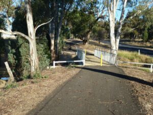
Entrance to trail at Macquarie St May 2012
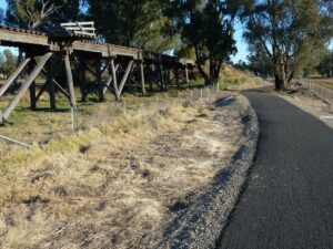
The old trestle railway bridge on the trail May 2012
Approaching the Macquarie River May 2012
The trail on the western side of the trail May 2012
The trail alongside the Obley Rd near Western Plains Zoo May 2012
Do you know of a bike hire or transportation service on this rail trail that should appear here? If so, let us know at admin@railtrails.org.au.
Information and Links
For more information, or to report damage or problems:
Dubbo City Council www.dubbo.nsw.gov.au
To view a copy of the Dubbo cycleways map click here
Contact Rail Trails Australia
To contact us about this rail trail, email nsw@railtrails.org.au
Background Information
Traditional Owners
We acknowledge the Wiradjuri people, the traditional custodians of the land and waterways on which the rail trail is built.
Rail Trail development
This trail is only a short section of a proposed rail trail between Dubbo and Molong. The longer section is not yet constructed or open.
Railway history
The Molong-Dubbo line branched off the Broken Hill railway line at Molong before rejoining it at Dubbo. The line is scenic and has several steel bridges and significant engineering works. New South Wales Government Railways intended it to become the main line to Dubbo: the line was approved in 1916, but World War I saw construction delayed until 1920. It opened in 1925 with expectations of high traffic but never reached its full potential.
Passenger services were operated by rail motors from 1932 and 1974. The rail motor was withdrawn in 1974 along with many other branch services during a nationwide fuel crisis. The line saw considerable local grain haulage, but the general freight downturn in the 1980s, the opening of the Ulan line, and a transfer of some grain haulage to road transport by the State Rail Authority saw the line truncated north of Yeoval in 1987, with the remainder closed in 1993.
Dubbo Tracker Riley Cyclepath extension
Posted: 25/06/12
The opening ceremony was held at Dundullimal homestead due to wet weather on the day. ...
More...Nearby Trails
Dubbo to Molong Rail Trail
400 km North West of Sydney

Nearby Trails
Dubbo to Molong Rail Trail
400 km North West of Sydney
2 reviews of “Dubbo Tracker Riley Cyclepath extension”
Not strictly a rail trail for the full length, but still a great cycle path with wonderful views of the river and the new weir and fishway. This cycleway is very popular at the moment due to the Covid restrictions. It seems that a lot of local people are discovering this for the first time.
This trail provides easy access to the Western Plains Zoo, as well as the historic Dundullimal homestead. There are numerous places to stop and rest, and to observe the birdlife next to the river.
I rode this trail yesterday afternoon (31/3/16). Firstly, Dubbo has great bike trails that are very good quality, the paths I rode are sealed and good gradients. This rail trail makes a great loop around Dubbo’s reserves and I thoroughly enjoyed it. The best section is down by the river and the new bridge – it’s a great country ride and plenty of bird life.